


GIS Mapping Services Using Drone LiDAR: Turning Survey Data into Actionable Project Intelligence
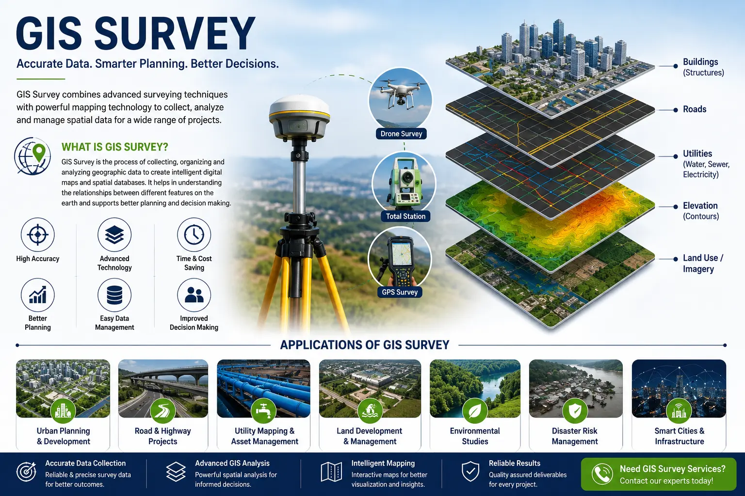
Geographic Information System (GIS) mapping for every infrastructure, industrial, mining, utility, and urban development project generates large amounts of location-based information. Land boundaries, utilities, roads, drainage systems, elevations, structures, environmental constraints, and asset locations all need to be managed throughout the project lifecycle.
The challenge is that this information often comes from multiple sources and formats, making it difficult to access, analyze, and update. As projects expand, the risk of data loss, design conflicts, incorrect measurements, and costly rework increases. This is where professional GIS mapping services become valuable. GIS transforms survey and engineering data into an organized digital platform that allows project teams to visualize, manage, and analyze assets from a single source of truth. When combined with Drone LiDAR surveys, GIS becomes even more powerful by providing highly accurate terrain and infrastructure data for planning and decision-making.
Read full article - https://www.sunconengineers.com/gis-mapping-companies/
Common Problems Faced Without GIS Mapping
Many organizations still rely on CAD drawings, spreadsheets, PDFs, and disconnected databases. This often leads to:
- Difficulty locating underground and above-ground assets
- Inaccurate land and infrastructure records
- Delays in project planning
- Design clashes during construction
- Challenges in monitoring large project areas
- Inefficient asset management
- Time-consuming data retrieval
- Increased project costs
How GIS Mapping Services Add Value to Projects
A GIS platform does much more than create maps. It helps project stakeholders make informed decisions throughout planning, design, construction, and operations.
Better Site Planning: Before any development begins, project teams need a clear understanding of existing site conditions. GIS mapping integrates topographic data, terrain information, utilities, access roads, water bodies, and environmental features into a single platform.
Improved Utility Management
Utility networks often become difficult to manage as projects grow. GIS mapping allows organizations to maintain accurate records of:
- Water pipelines
- Sewer networks
- Electrical infrastructure
- Telecom networks
- Gas pipelines
- Stormwater systems
Faster Decision-Making: Project managers and engineers can instantly access spatial information without searching through multiple drawings and reports. This reduces delays and improves project coordination.
Reduced Construction Risks: Accurate GIS datasets help identify potential conflicts before construction begins, minimizing redesigns, rework, and project delays.
Asset Lifecycle Management: GIS continues to provide value long after project completion by supporting maintenance, inspections, upgrades, and operational management.
Why Drone LiDAR Improves GIS Accuracy
Traditional surveys provide valuable data, but large and complex sites often require faster and more detailed information. Drone LiDAR technology captures millions of elevation points across the site, producing highly accurate terrain models and infrastructure data.
Benefits include:
- Faster coverage of large project areas
- High-density spatial data
- Accurate terrain representation
- Mapping beneath vegetation cover
- Reduced field time
- Improved project efficiency
GIS Deliverables That Clients Actually Use
A professional GIS mapping project can provide:
- Digital Asset Inventory: A centralized database of all project assets and infrastructure.
- Utility Mapping: Accurate locations of existing utility networks.
- Digital Terrain Models (DTM): Detailed ground surface information for planning and design.
- Infrastructure Mapping: Roads, buildings, drainage systems, pipelines, and other assets mapped within a GIS environment.
- Interactive GIS Dashboard: Web-based platforms allowing project teams to view and analyze data from any location.
- Land Information System: Property, ownership, and land-use information integrated into GIS for easy access.
For more info - https://www.sunconengineers.com

 English
 Arabic
 French
 Spanish
 Portuguese
 Deutsch
 Turkish
 Dutch
Dutch
 Italiano
 Russian
 Portuguese (Brazil)
 Greek
Greek